🇵🇱
🚶 Wirtualna wędrówka: Zejście z Zadnich Gór przez Makowicę do Rytra, Polska
🏞️ Trasa: Zadnie Góry (968 m n.p.m.; 49.489984, 20.733492) – Rozdroże pod Makowicą (921 m n.p.m.; 49.494020, 20.726221) – Makowica (948 m n.p.m.; 49.496767, 20.713035) – Polana Makowica (869 m n.p.m.; 49.498660, 20.708435) – Podmakowica (651 m n.p.m.; 49.503733, 20.704787) – Rytro, Życzanów (337 m n.p.m.; 49.500819, 20.677259)
🆔 Oznaczenie: czerwony szlak, niebieski szlak, szlak spacerowy żółty
📏 Długość: około 6,3 km
⏲️ Czas przejścia: około 1:50 h
↗️ Suma podejść: 64 m
↘️ Suma zejść: 693 m
00:00:22 Zadnie Góry
00:14:19 Rozdroże pod Makowicą
00:38:05 Makowica
00:49:11 Polana Makowica
01:16:29 Potok
01:18:19 Skrzyżowanie szlaku niebieskiego i żółtego szlaku spacerowego
01:20:30 Podmakowica
01:53:55 Potok
01:58:51 Rytro, Życzanów
01:59:13 Poprad
Beskid Sądecki – pasmo górskie w Karpatach Zachodnich, należące do Beskidów Zachodnich, w Polsce. W skład Beskidu Sądeckiego wchodzą dwa pasma: Jaworzyny i Radziejowej. Rozciąga się na powierzchni ok. 670 km², pomiędzy Dunajcem na zachodzie a dolinami Kamienicy, Mochnaczki, Muszynki i Przełęczą Tylicką na wschodzie. Najwyższym szczytem jest Radziejowa (1262 m n.p.m.).
Góry zbudowane są z fliszu płaszczowiny magurskiej. Porastają je lasy mieszane, w kilku chronionych rezerwatach występuje buczyna karpacka, Jawory występują już rzadko. Świerki zostały sztucznie nasadzone w uzupełnieniu wyciętych drzew. Za naturalne drzewostany świerkowe uważa się tylko świerkowe lasy w szczytowych partiach Radziejowej, Złomistego Wierchu i Wielkiego Rogacza. Nad potokami i rzekami występują łęgi, a na stromych skarpach nad Popradem i Dunajcem niewielkie grądy. Wielką rzadkością jest zachowany naturalny fragment lasu lipowego, chroniony w rezerwacie przyrody Las Lipowy Obrożyska.
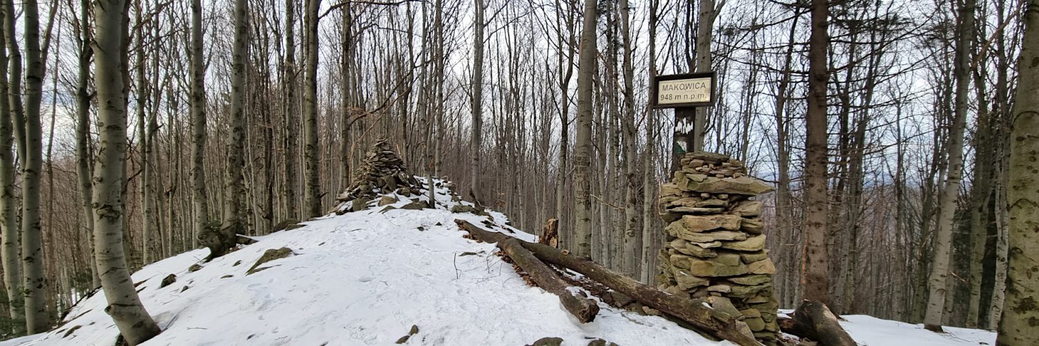
Makowica – szczyt o wysokości 948 m n.p.m. w Beskidzie Sądeckim. Położony jest w zachodniej części Pasma Jaworzyny Krynickiej, ciągnącego się od Barcic po Tylicz. Makowica wznosi się na wschód od doliny Popradu i drogi Nowy Sącz – Piwniczna-Zdrój na wysokości Rytra. Wschodnia część Makowicy opada do doliny dwóch potoków: Życzanowskiego Potoku i Głęboczanki. Północne stoki docierają również do doliny Życzanowskiego Potoku. Zachodnie stoki Makowicy docierają Popradu.
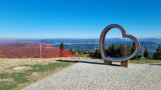
Obecnie Makowica jest w dużej części zalesiona. Dawne polany pasterskie zarastają lasem. Największa z nich to Makowica, na której znajduje się należący do miejscowości Sucha Struga przysiółek Makowica. Z górnej części polany roztacza się rozległy widok na Pasmo Radziejowej, Gorce i Beskid Wyspowy. Na zachodnich stokach, nad Życzanowskim Potokiem, położony jest na polanach należący do Rytra przysiółek Podmakowica. Na północno-wschodnim stoku góry, na wysokości 844 m n.p.m. przy Głównym Szlaku Beskidzkim na polanie Cyrla znajduje się Schronisko Cyrla. Jeszcze niżej znajduje się polana Kretówki, a na stokach północnych są polany Gawlaki i Łomy.
Na szczycie porośniętym lasem znajduje się kilka niewielkich wychodni skalnych.
Film zarejestrowany w dniu 22 stycznia 2024 roku.
🇬🇧
The second part of the winter hike in the Sącz Beskid Mountains. We descend the red trail from Zadnie Góry to Crossroads near Makowica, where the red, blue and green trails intersect. Then ascend the blue trail to Makowica Mountain, a forested peak with small rock outcrops. From Makowica we go down to Makowica Glade, from which there is a wide view of the Wyspowy Beskid, the Gorce Mountains and the Radziejowa Range. Further along the blue trail we reach the hamlet of Podmakowica, from which you can also admire beautiful mountain panoramas. Following the yellow walking trail we reach Rytro.
🚶 Virtual hike: Descent from Zadnie Góry through Makowica to Rytro, Poland
🏞️ Route: Zadnie Góry (968 m a.s.l.; 49.489984, 20.733492) – Crossroads near Makowica (921 m a.s.l.; 49.494020, 20.726221) – Makowica Mountain (948 m a.s.l.; 49.496767, 20.713035) – Makowica Glade (869 m a.s.l.; 49.498660, 20.708435) – Podmakowica (651 m a.s.l.; 49.503733, 20.704787) – Rytro, Życzanów (337 m a.s.l.; 49.500819, 20.677259)
🆔 Trail designation: red trail, blue trail, yellow walking trail
📏 Length: about 5.3 km
⏲️ Walking time: about 1:50 h
↗️ Sum of approaches: 64 m
↘️ Sum down: 693 m
00:00:22 Zadnie Góry
00:14:19 Crossroads near Makowica
00:38:05 Makowica Mountain
00:49:11 Makowica Glade
01:16:29 Stream
01:18:19 Crossing of the blue trail and the yellow walking trail
01:20:30 Podmakowica
01:53:55 Stream
01:58:51 Rytro, Życzanów
01:59:13 Poprad River
Sącz Beskid Mountains – a mountain range in the Western Carpathians, belonging to the Western Beskids, in Poland. The Sącz Beskid Mountains consists of two ranges: Jaworzyna and Radziejowa. It stretches over an area of approximately 670 km², between the Dunajec River in the west and the valleys of Kamienica, Mochnaczka, Muszynka and the Tylicka Pass in the east. The highest peak is Radziejowa (1262 m a.s.l.).
The mountains are made of flysch of the Magura Nappe. They are overgrown with mixed forests, in several protected reserves there is Carpathian beech forest, Sycamores are rare. The spruces were artificially planted in addition to the cut trees. Only spruce forests in the top parts of Radziejowa, Złomisty Wierch and Wielki Rogacz are considered natural spruce stands. There are riparian forests over streams and rivers, and small oak-hornbeam forests on the steep escarpments of the Poprad and Dunajec rivers. A great rarity is the preserved natural fragment of the linden forest, protected in the nature reserve Las Lipowy Obrożyska.
Makowica Mountain – a peak with a height of 948 m a.s.l. in the Sącz Beskid Mountains. It is located in the western part of the Jaworzyna Krynicka Range, stretching from Barcice to Tylicz. Makowica rises east of the Poprad valley and the Nowy Sącz – Piwniczna-Zdrój road, at the height of Rytro. The eastern part of Makowica descends into the valley of two streams: Żanowski Stream and Głęboczanka Stream. The northern slopes also reach the Żanowski Stream valley. The western slopes of Makowica reach Poprad River.
Currently, Makowica is largely forested. Former shepherd’s clearings are becoming overgrown with forest. The largest of them is Makowica, where the hamlet of Makowica, belonging to the village of Sucha Struga, is located. From the upper part of the clearing there is a vast view of the Radziejowa Range, the Gorce Mountains and the Wyspowy Beskid. On the western slopes, by Żanowski Stream, the hamlet of Podmakowica, belonging to Rytro, is located in the clearings. On the north-eastern slope of the mountain, at an altitude of 844 m a.s.l. on the Main Beskid Trail, in the Cyrla clearing, there is the Cyrla Shelter. Even lower there is the Kretówki clearing, and on the northern slopes there are the Gawlaki and Łomy clearings.
On the forest-covered peak there are several small rock outcrops.


