🇵🇱
🚶 Wirtualna wędrówka: Wejście na Złomisty Wierch z Roztoki Ryterskiej, Polska
🏞️ Trasa: Roztoka Ryterska, parking (464 m n.p.m.; 49.483928, 20.643472) – Stary Kamieniołom (528 m n.p.m.; 49.479748, 20.629002) – Wdżary Niżne (778 m n.p.m.; 49.484737, 20.616045) – Wdżary Wyżne (856 m n.p.m.; 49.480366, 20.602262) – Wietrzne Dziury (1038 m n.p.m.; 49.475458, 20.581427) – Rozdroże Zwornik (1138 m n.p.m.; 49.469581, 20.572862) – Rozdroże Pod Wielką Przehybą (1136 m n.p.m.; 49.466862, 20.566940) – Złomista Przełęcz (1171 m n.p.m.; 49.466064, 20.574710) – Złomisty Wierch Północny (1189 m n.p.m.; 49.465230, 20.577500) – Złomisty Wierch (1224 m n.p.m.; 49.460304, 20.577736)
🆔 Oznaczenie: niebieski szlak, czerwony szlak
📏 Długość: około 8,5 km
⏲️ Czas przejścia: około 3:00 h
↗️ Suma podejść: 801 m
↘️ Suma zejść: 52 m
00:00:40 Roztoka Ryterska, parking
00:00:58 Wielka Roztoka
00:03:51 Wielka Roztoka
00:04:49 Pomnik Partyzantów Ziemi Sądeckiej
00:05:28 Źródełko
00:09:25 Wielka Roztoka
00:10:52 Kapliczka
00:11:56 Wielka Roztoka
00:13:38 Wielka Roztoka
00:18:29 Stary Kamieniołom
00:19:07 Wielka Roztoka
00:46:27 Wdżary Niżne
00:57:39 Polana Wdżary Wyżne
01:06:09 Zejście ze szlaku
01:07:23 Wdżary Wyżne
01:09:25 Powrót na niebieski szlak
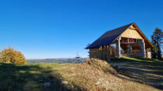
01:25:37 Schron turystyczny
01:43:16 Zejście ze szlaku
01:47:20 Wietrzne Dziury
01:51:55 Powrót na niebieski szlak
02:12:24 Rozdroże Zwornik
02:21:16 Rozdroże Pod Wielką Przehybą
02:32:48 Złomista Przełęcz
02:38:04 Złomisty Wierch Północny
02:48:25 Złomisty Wierch
Beskid Sądecki – pasmo górskie w Karpatach Zachodnich, należące do Beskidów Zachodnich, w Polsce. W skład Beskidu Sądeckiego wchodzą dwa pasma: Jaworzyny i Radziejowej. Rozciąga się na powierzchni ok. 670 km², pomiędzy Dunajcem na zachodzie a dolinami Kamienicy, Mochnaczki, Muszynki i Przełęczą Tylicką na wschodzie. Najwyższym szczytem jest Radziejowa (1262 m n.p.m.).
Góry zbudowane są z fliszu płaszczowiny magurskiej. Porastają je lasy mieszane, w kilku chronionych rezerwatach występuje buczyna karpacka, Jawory występują już rzadko. Świerki zostały sztucznie nasadzone w uzupełnieniu wyciętych drzew. Za naturalne drzewostany świerkowe uważa się tylko świerkowe lasy w szczytowych partiach Radziejowej, Złomistego Wierchu i Wielkiego Rogacza. Nad potokami i rzekami występują łęgi, a na stromych skarpach nad Popradem i Dunajcem niewielkie grądy. Wielką rzadkością jest zachowany naturalny fragment lasu lipowego, chroniony w rezerwacie przyrody Las Lipowy Obrożyska.
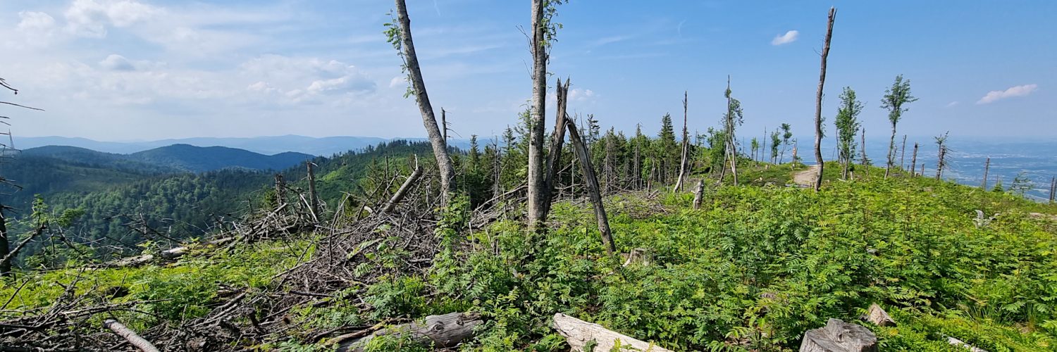
Złomisty Wierch – szczyt o wysokości 1224 m n.p.m. w Beskidzie Sądeckim, w Paśmie Radziejowej. Jest drugim co do wysokości szczytem Beskidu Sądeckiego. Około 550 m na północ znajduje się jego niższy wierzchołek – Złomisty Wierch Północny o wysokości 1189 m n.p.m. Od niego odchodzi w północno-wschodnim kierunku krótki boczny grzbiet kończący się Konieczną Górą (990 m n.p.m.). Grzbiet ten oddziela dolinę potoku Szczecina od doliny Potoku Średniego i znajduje się na nim widokowa Hala Konieczna. Od południowo-zachodniej strony stoki obydwu wierzchołków Złomistego Wierchu opadają do górnej części doliny Starego Potoku. Szczyt obecnie nie jest zalesiony, roztacza się z niego szeroka panorama Beskidu Sądeckiego, Pienin a w oddali widać również Tatry.
Wdżary Wyżne – szczyt o wysokości 856 m n.p.m. w Beskidzie Sądeckim. Znajduje się na północno-wschodnim grzbiecie Wielkiej Przehyby, który poprzez Wietrzne Dziury, Wdżary Wyżne i Połom opada do doliny Popradu w Rytrze. Wschodnie stoki Wdżarów Wyżnych opadają do doliny potoku Borsudzyny, stoki zachodnie do doliny Przysietnickiego Potoku. Sam wierzchołek Wdżarów Wyżnych jest zalesiony, ale przez prześwity między drzewami i zarastającą polanę widok na Halę Konieczną i głęboką dolinę Wielkiej Roztoki i jej otoczenie.
Poniżej wierzchołka, na północnym grzbiecie znajduje się polana Wdżary Wyżne. Roztaczają się z niej ograniczone widoki na zachodnią stronę na Beskid Wyspowy i Kotlinę Sądecką.
Wietrzne Dziury (Diabli Garnek) – szczyt o wysokości 1038 m n.p.m. w Beskidzie Sądeckim. Znajduje się na północno-wschodnim grzbiecie Wielkiej Przehyby, który poprzez Wietrzne Dziury, Wdżary Wyżne i Połom opada do doliny rzeki Poprad w miejscowości Rytro.
Poniżej wierzchołka, na wysokości 1020 m n.p.m., znajduje się zapadlisko, powstałe w wyniku osunięcia się mas skalnych. Powstał rów rozpadlinowy, w którym znajdują się wydłużone wały zamknięte niszami o długości do 40 metrów, rozległe i głębokie do 3,5 metra. Wysoka na 15,5 metra ściana skalna odsłania silnie spękane piaskowce magurskie. Na skałach można obserwować typową dla tych siedlisk roślinność. Są to kobierce mchów oraz paprocie: zanokcica skalna, paprotka zwyczajna, paprotnik Brauna i inne.
Film zarejestrowany w dniu 20 czerwca 2023 roku.
🇬🇧
A beautiful and scenic hike in the Sącz Beskid Mountains. From the car park in Roztoka Ryterska, we set off along the blue trail towards Przehyba. Initially, the trail leads along the picturesque Wielka Roztoka stream. At the Old Quarry, we turn right and ascend quite intensively to Wdżary Niżne. Further on, the trail, with a gentler approach, leads to Wdżary Wyżne. In places there are already views of the Sącz Beskid Mountains and the Wyspowy Beskid. The next peak is Wietrzne Dziury with an interesting sinkhole below the top. A little further on, the forest thins out and we can admire vast panoramas in every direction. We pass the Zwornik and Pod Wielka Przehyba crossroads, where we enter the red trail. We pass Wielka Przehyba and ascend a beautiful scenic path to Złomisty Wierch.
🚶 Virtual hike: Ascent to Złomisty Wierch Mountain from Roztoka Ryterska, Poland
🏞️ Route: Roztoka Ryterska, parking (464 m a.s.l.; 49.483928, 20.643472) – Old Quarry (528 m a.s.l.; 49.479748, 20.629002) – Wdżary Niżne (778 m a.s.l.; 49.484737, 20.616045) – Wdżary Wyżne (856 m a.s.l.; 49.480366, 20.602262) – Wietrzne Dziury (1038 m a.s.l.; 49.475458, 20.581427) – Zwornik Crossroads (1138 m a.s.l.; 49.469581, 20.572862) – Wielka Przehyba Crossroads (1136 m a.s.l.; 49.466862, 20.566940) – Złomista Pass (1171 m a.s.l.; 49.466064, 20.574710) – Złomisty Wierch Północny (1189 m a.s.l.; 49.465230, 20.577500) – Złomisty Wierch (1224 m a.s.l.; 49.460304, 20.577736)
🆔 Trail designation: blue trail, red trail
📏 Length: about 8.5 km
⏲️ Walking time: about 3:00 h
↗️ Sum of approaches: 801 m
↘️ Sum down: 52 m
00:00:40 Roztoka Ryterska, parking
00:00:58 Wielka Roztoka Stream
00:03:51 Wielka Roztoka Stream
00:04:49 Monument to Partisans of the Nowy Sącz Land
00:05:28 Spring
00:09:25 Wielka Roztoka Stream
00:10:52 Chapel
00:11:56 Wielka Roztoka Stream
00:13:38 Wielka Roztoka Stream
00:18:29 Old Quarry
00:19:07 Wielka Roztoka Stream
00:46:27 Wdżary Niżne
00:57:39 Wdżary Wyżne Glade
01:06:09 Going off the trail
01:07:23 Wdżary Wyżne
01:09:25 Return to the blue trail
01:25:37 Tourist shelter
01:43:16 Going off the trail
01:47:20 Wietrzne Dziury
01:51:55 Return to the blue trail
02:12:24 Zwornik Crossroads
02:21:16 Wielka Przehyba Crossroads
02:32:48 Złomista Pass
02:38:04 Złomisty Wierch Północny
02:48:25 Złomisty Wierch
Sącz Beskid Mountains – a mountain range in the Western Carpathians, belonging to the Western Beskids, in Poland. The Sącz Beskid Mountains consists of two ranges: Jaworzyna and Radziejowa. It stretches over an area of approximately 670 km², between the Dunajec River in the west and the valleys of Kamienica, Mochnaczka, Muszynka and the Tylicka Pass in the east. The highest peak is Radziejowa (1262 m a.s.l.).
The mountains are made of flysch of the Magura Nappe. They are overgrown with mixed forests, in several protected reserves there is Carpathian beech forest, Sycamores are rare. The spruces were artificially planted in addition to the cut trees. Only spruce forests in the top parts of Radziejowa, Złomisty Wierch and Wielki Rogacz are considered natural spruce stands. There are riparian forests over streams and rivers, and small oak-hornbeam forests on the steep escarpments of the Poprad and Dunajec rivers. A great rarity is the preserved natural fragment of the linden forest, protected in the nature reserve Las Lipowy Obrożyska.
Złomisty Wierch Mountain – a peak with a height of 1224 m a.s.l. in the Sącz Beskid Mountains, in the Radziejowa Range. It is the second highest peak of Sącz Beskid Mountains. About 550 m to the north there is its lower peak – Złomisty Wierch Północny with a height of 1189 m a.s.l. From it, in the north-eastern direction, a short side ridge ends with Konieczna Góra (990 m a.s.l). This ridge separates the valley of the Szczecina stream from the valley of the Średni Potok and there is a viewing Hala Konieczna on it. From the south-west, the slopes of both peaks of Złomisty Wierch descend to the upper part of the Stary Potok valley. The peak is currently not forested, there is a wide panorama of Sącz Beskid Mountains, Pieniny and the Tatra Mountains in the distance.
Wdżary Wyżne – a peak with a height of 856 m a.s.l. in Sącz Beskid Mountains. It is located on the north-eastern ridge of Wielka Przehyba, which, through Wietrzne Dziury, Wdżary Wyżne and Połom, descends to the Poprad valley in Rytro. The eastern slopes of Wdżary Wyżne descend into the valley of the Borsudzyny stream, the western slopes into the valley of the Przysietnicki Stream. The very top of Wdżary Wyżne is forested, but through the gaps between the trees and the overgrowing glade you can see Hala Konieczna and the deep valley of Wielka Roztoka and its surroundings.
Below the top, on the northern ridge, there is a glade called Wdżary Wyżne. It offers limited views of the western side of the Wyspowy Beskid and Saącz Valley.
Wietrzne Dziury (Diabli Garnek) – a peak with a height of 1038 m a.s.l. in the Sącz Beskid Mountains. It is located on the north-eastern ridge of Wielka Przehyba, which, through Wietrzne Dziury, Wdżary Wyżne and Połom, descends into the valley of the Poprad River in Rytro.
Below the peak, at an altitude of 1020 m a.s.l., there is a sinkhole, formed as a result of a rock mass slide. A cleft ditch was created with elongated embankments closed with niches up to 40 meters long, wide and up to 3.5 meters deep. The 15.5 meter high rock wall reveals strongly cracked Magura sandstones. On the rocks you can observe vegetation typical of these habitats. These are carpets of mosses and ferns: rock parrot, common fern, Braun’s fern and others.
The film was recorded on June 20, 2023.


