🇵🇱
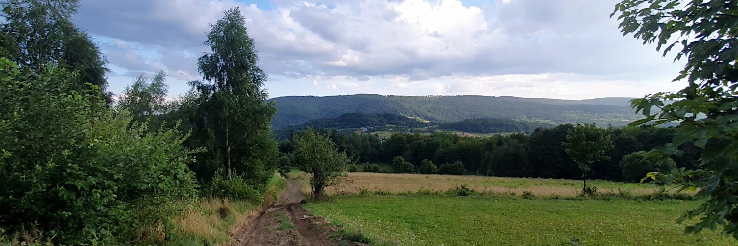
🚶 Wirtualna wędrówka: Babica z Bieńkówki, Polska
🏞️ Trasa: Bieńkówka Celakówka (486 m n.p.m.; 49.776118, 19.771775) – Babica Zachodnia (633 m n.p.m.; 49.784934, 19.766220) – Babica (727 m n.p.m.; 49.787637, 19.801483) – Bieńkówka kolonia U Lacha na górze (585 m n.p.m.; 49.779158, 19.797363)
🆔 Oznaczenie: niebieski szlak, czerwony szlak
📏 Długość: około 5,2 km
⏲️ Czas przejścia: około 1:40 h
↗️ Suma podejść: 235 m
↘️ Suma zejść: 141 m
00:00:22 Bieńkówka Celakówka
00:21:52 Babica Zachodnia
00:22:10 Skrzyżowanie niebieskiego, czerwonego i czarnego szlaku
00:28:08 Skrzyżowanie czerwonego i czarnego szlaku
01:01:21 Kapliczka
01:01:49 Babica
01:07:03 Zejście ze szlaku
01:20:41 Kapliczka
01:20:53 Bieńkówka kolonia U Lacha na górze
Beskid Makowski – grupa górska stanowiąca część Beskidów Zachodnich, leżąca w południowej Polsce, w Europie Środkowej. Składa się z wielu rozczłonkowanych pasm górskich i wzniesień pomiędzy którymi wyrzeźbione zostały doliny górskie. Według nowej regionalizacji fizycznogeograficznej z 2018 roku najwyższym szczytem jest Lubomir (904 m n.p.m.).
Babica (727 m n.p.m.) – szczyt w Beskidzie Makowskim, w Paśmie Babicy. Szczyt porasta zwarty las. Pod szczytem Babicy znajduje się polana nazywana „Pod Działem”, która jest punktem widokowy na dolinę Trzebunki i jej otoczenie. Stanowi ona fragment użytków rolnych, które na przełomie XIX i XX w. obejmowały cały południowy stok oraz grzbiet wzgórza.
Film zarejestrowany w dniu 28 lipca 2021 roku.
🇬🇧
🚶 Virtual hike: Babica Mountain from Bieńkówka Village, Poland
🏞️ Route: Bieńkówka Celakówka (486 m a.s.l.; 49.776118, 19.771775) – Western Babica Mountain (633 m a.s.l.; 49.784934, 19.766220) – Babica Mountain (727 m a.s.l.; 49.787637, 19.801483) – Bieńkówka U Lacha na górze colony (585 m a.s.l.; 49.779158, 19.797363)
🆔 Trail designation: blue trail, red trail
📏 Length: about 5.2 km
⏲️ Walking time: about 1:40 h
↗️ Sum of approaches: 235 m
↘️ Sum down: 141 m
00:00:22 Bieńkówka Celakówka
00:21:52 Western Babica Mountain
00:22:10 Crossroads of the blue trail, the red trail and the black trail
00:28:08 Crossroads of the black trail and the red trail
01:01:21 Chapel
01:01:49 Babica Mountain
01:07:03 Going off the trail
01:20:41 Chapel
01:20:53 Bieńkówka U Lacha na górze colony
Makowski Beskid – a mountain group that is part of the Western Beskids, located in southern Poland, in Central Europe. It consists of many fragmented mountain ranges and hills between which mountain valleys have been carved. According to the new 2018 physical and geographic regionalization, the highest peak is Lubomir (904 m a.s.l.).
Babica Mountain (727 m a.s.l.) – the peak in the Makowski Beskid, in the Babica Range. The summit is covered with a dense forest. Under the peak of Babica there is a glade called „Pod Działem”, which is a viewpoint over the Trzebunki valley and its surroundings. It is a fragment of agricultural land that at the turn of the 19th and 20th centuries covered the entire southern slope and the ridge of the hill.
The film was recorded on July 28, 2021.


