
🇵🇱
🚶 Wirtualna wędrówka: Zejście z Koziarza przez Sobel Tylmanowski do Tylmanowej, Polska
🏞️ Trasa: Koziarz (942 m n.p.m.; 49.495215, 20.443609) – Suchy Groń (855 m n.p.m.; 49.505955, 20.445385) – Sobel Tylmanowski (713 m n.p.m.; 49.508463, 20.429549) – Tylmanowa parking (383 m n.p.m.; 49.516461, 20.398816)
🆔 Oznaczenie: żółty szlak, droga bez szlaku, zielony szlak
📏 Długość: około 4,9 km
⏲️ Czas przejścia: około 1:20 h
↗️ Suma podejść: 30 m
↘️ Suma zejść: 554 m
00:00:22 Koziarz
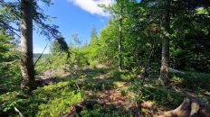
00:12:57 Zejście ze szlaku
00:13:37 Suchy Groń
00:15:43 Powrót na żółty szlak
00:16:53 Zejście ze szlaku
00:30:27 Szczyt bez nazwy
00:37:09 Sobel Tylmanowski
01:02:59 Tylmanowa
01:12:15 Dunajec
01:13:45 Pomnik ku czci Bohaterów I Wojny Światowej
01:14:19 Tylmanowa parking
Beskid Sądecki – pasmo górskie w Karpatach Zachodnich, należące do Beskidów Zachodnich, w Polsce, Europa Centralna. W skład Beskidu Sądeckiego wchodzą trzy pasma: Jaworzyny, Radziejowej i Góry Leluchowskie. Góry zachwycają pięknymi krajobrazami i miejscami widokowymi. Najwyższym szczytem jest Radziejowa (1262 m n.p.m.).
Suchy Groń – szczyt w Beskidzie Sądeckim w Paśmie Radziejowej o wysokości 855 m n.p.m. Poniżej zalesionego szczytu od strony północno-wschodniej znajduje się widokowa polana. W kierunku zachodnim, do Dunajca, odchodzi od Suchego Gronia krótki grzbiet z kulminacją Sobla Tylmanowskiego.
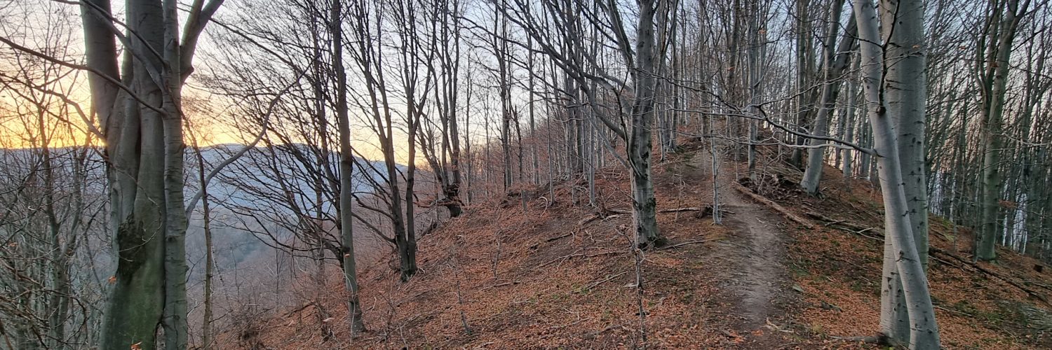
Sobel Tylmanowski – całkowicie porośnięty lasem szczyt w Beskidzie Sądeckim w Paśmie Radziejowej o wysokości 713 m n.p.m. Wznosi się w grzbiecie opadającym z Suchego Gronia do Dunajca w miejscowości Tylmanowa. Grzbiet ten oddziela dolinki dwóch potoków spływających do Dunajca; potok po północnej stronie jest bezimienny, potok po południowej stronie na mapie opisany jest jako Bar.
Film zarejestrowany w dniu 11 listopada 2021 roku.
🇬🇧
🚶 Virtual hike: Descent from Koziarz Mountain through Tylmanowa Sobel Mountain to Tylmanowa, Poland
🏞️ Route: Koziarz Mountain (942 m a.s.l.; 49.495215, 20.443609) – Suchy Groń Mountain (855 m a.s.l.; 49.505955, 20.445385) – Tylmanowa Sobel Mountain (713 m a.s.l.; 49.508463, 20.429549) – Tylmanowa parking (383 m a.s.l.; 49.516461, 20.398816)
🆔 Trail designation: yellow trail, road without trail, green trail
📏 Length: about 4.9 km
⏲️ Walking time: about 1:20 h
↗️ Sum of approaches: 30 m
↘️ Sum down: 554 m
00:00:22 Koziarz Mountain
00:12:57 Going off the trail
00:13:37 Suchy Groń Mountain
00:15:43 Return to the yellow trail
00:16:53 Going off the trail
00:30:27 Nameless peak
00:37:09 Tylmanowa Sobel Mountain
01:02:59 Tylmanowa
01:12:15 Dunajec River
01:13:45 Monument in honor of the heroes of the First World War
01:14:19 Tylmanowa parking
Sącz Beskid Mountains – a mountain range in the Western Carpathians, belonging to the Western Beskids, in Poland, Central Europe. The Sącz Beskid Mountains range consists of three ranges: Jaworzyna, Radziejowa and the Leluchowskie Mountains. The mountains delight with beautiful landscapes and viewpoints. The highest peak is Radziejowa (1262 m a.s.l.).
Suchy Groń Mountain – the peak in Beskid Sądecki in the Radziejowa Range, 855 m a.s.l. Below the forested peak on the north-eastern side there is a viewing glade. Towards the west, to the Dunajec River, a short ridge departs from Suchy Groń Mountain, culminating in Tylmanowa Sobel Mountain.
Tylmanowa Sobel Mountain – a peak completely covered with forest in the Beskid Sądecki in the Radziejowa Range with a height of 713 m a.s.l. It rises in the ridge falling from Suchy Groń Mountain to Dunajec River in the village of Tylmanowa. This ridge separates the valleys of two streams flowing down to the Dunajec River; the northern stream is nameless, the southern stream is described on the map as Bar Stream.
The film was recorded on November 11, 2021.