
🇸🇰
🚶 Virtuálna prechádzka: Výstup na Stebnícku Maguru z Bardejovských Kúpeľov, Slovensko
🏞️ Trasa: Bardejovské Kúpele, Parkovisko (318 m n.m.; 49.326550, 21.275711) – Kút (519 m n.m.; 49.345466, 21.268244) – Pod Magurou (581 m n.m.; 49.357995, 21.257254) – Stebnícka Magura (900 m n.m.; 49.359839, 21.245504)
🆔 Označenie chodníka: žltý chodník, červený chodník
📏 Dĺžka: približne 6,4 km
⏲️ Čas chôdze: približne 2:50 h
↗️ Suma prístupov: 605 m
↘️ Zostup: 41 m
00:00:29 Bardejovské Kúpele, parkovisko
00:06:45 Križovatka žltého chodníka a červeného chodníka
00:08:53 Križovatka žltého chodníka a červeného chodníka
00:16:31 Bardejovský potok
00:16:42 Rybník
00:22:15 Bardejovský potok
00:29:17 Prameň
00:42:06 Doly Prameň
00:47:32 Kút
01:26:56 Pod Magurou
01:27:10 Križovatka žltého chodníka a červeného chodníka
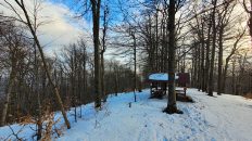
02:39:05 Stebnícka Magura
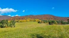
Nízke Beskydy – pohorie v Karpatoch, ktoré sa nachádza v severovýchodnej časti Slovenska a juhovýchodnej časti Poľska. Najvyšším vrchom je Busov (1002 m n. m.).
Tvorí ho komplex krajinných celkov, ktoré sú spojnicou medzi Západnými a Východnými Karpatmi. Zahŕňa tieto krajinné celky na Slovensku: Busov, Ondavská vrchovina, Laborecká vrchovina a Beskydské predhorie. Existujú len dve vegetačné vrstvy: podhorské (do 550 m n. m.) a spodný horský les. Predhorie tvoria zvyšky pôvodných dubových a hrabových lesov, jelšových a prútených húštin v údoliach riek, kým nižšie horské lesy sú jedľové, bukové a borovicové. Početné sú najmä bukové porasty, takmer chýba smrek.
Nízke Beskydy tvoria priečnu morfoštruktúrnu depresiu medzi Východoslovenskou nížinou a Sandomierskou kotlinou. Sú v nich zastúpené len 2 základné tektonické jednotky Karpát – vonkajšie flyšové pásmo na severe a mrenové pásmo na juhu. Diverzifikáciou tektonických pohybov a exogénnych procesov sa tu objavili dva typy reliéfu: erózne brázdy až tektonicko-erózne a pahorkatiny a štruktúrne chrbty až tektonicko-štrukturálne v reliéfe vrchoviny.
Stebnícka Magura – vrchol 900 m n.m. v Nízkych Beskydách, v pohorí Busov. Týči sa severne od Bardejova, jasne dominuje celému územiu. Hora je celá pokrytá lesom.
Východné a severné svahy pohoria pokrýva prírodná rezervácia „Stebnícka Magura“, založená v roku 1964. Svojou rozlohou zaberá vlhkú oblasť prameňov Stebnického Potoka.
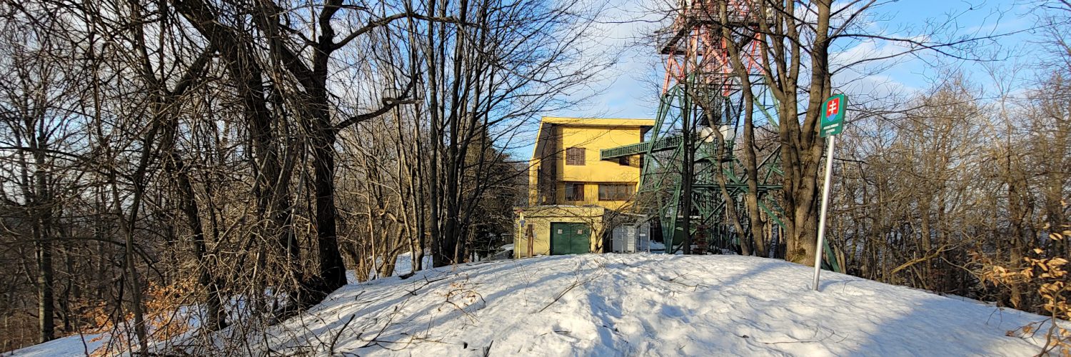
Na vrchole sa nachádza 81 m vysoký oceľový stožiar rozhlasového a televízneho vysielača z roku 1975 a budova technického zázemia.
Video natočené 22. februára 2023.
🇬🇧
Winter hiking in the Low Beskid Mountains in Slovakia. From the car park in the spa town of Bardejovské Kúpele, we ascend Stebnícka Magura from the north. Initially, the yellow trail leads along the Bardejovský Stream and then along paths through the forest, passing two springs. At the Pod Magurou crossroads of trails, we take the red trail and ascend steeply through very deep snow to Stebníká Magura.
🚶 Virtual hike: Ascent to Stebnícka Magura Mountain from Bardejovské Kúpele, Slovakia
🏞️ Route: Bardejovské Kúpele, parking (318 m a.s.l.; 49.326550, 21.275711) – Kút (519 m a.s.l.; 49.345466, 21.268244) – Pod Magurou (581 m a.s.l.; 49.357995, 21.257254) – Stebnícka Magura (900 m a.s.l.; 49.359839, 21.245504)
🆔 Trail designation: yellow trail, red trail
📏 Length: about 6.4 km
⏲️ Walking time: about 2:50 h
↗️ Sum of approaches: 605 m
↘️ Sum down: 41 m
00:00:29 Bardejovské Kúpele, parking
00:06:45 Crossing of the yellow and the red trails
00:08:53 Crossing of the yellow and the red trails
00:16:31 Bardejovský potok
00:16:42 Pond
00:22:15 Bardejovský potok
00:29:17 Spring
00:42:06 Doly Spring
00:47:32 Kút
01:26:56 Pod Magurou
01:27:10 Crossing of the yellow and the red trails
02:39:05 Stebnícka Magura
Low Beskid Mountains – a mountain range in the Carpathians, located in the north-eastern part of Slovakia and south-eastern part of Poland. The highest peak is Busov (1002 m a.s.l.).
It consists of a complex of landscape units that are a link between the Western and Eastern Carpathians. It includes the following landscape units in Slovakia: Busov, Ondavská vrchovina, Laborecká vrchovina and Beskydské predhorie. There are only two vegetation layers: the foothills (up to 550 m above sea level) and the lower montane forest. The foothills are made up of the remains of original oak and hornbeam forests, alders and wicker thickets in the river valleys, while the lower montane forests are fir, beech and pine forests. Beech stands are particularly numerous, and spruce is almost absent.
The Low Beskid Mountains form a transverse morphostructural depression between the East Slovak Lowland and the Sandomierz Basin. Only 2 basic tectonic units of the Carpathians are represented in them – the outer flysch belt in the north and the barbel belt in the south. The diversification of tectonic movements and exogenous processes resulted in the appearance of two types of relief here: erosion furrows to tectonic-erosive and hilly basins, and structural ridges to tectonic-structural in upland relief.
Stebnícka Magura – a peak 900 m a.s.l. in the Low Beskid Mountains, in the Busov Mountains. It rises north of Bardejov, clearly dominating the entire area. The mountain is completely covered with forest.
The eastern and northern slopes of the mountain are covered by the nature reserve „Stebnícka Magura“, established in 1964. Its area covers the humid area of the springs of Stebnický Potok.
At the top there is an 81 m high steel mast of a radio and television transmitter built in 1975 and a building of technical facilities.
The film was recorded on February 22, 2023.