
🇵🇱
🚶 Wirtualna wędrówka: Zejście z Gorca przez polanę Gorc Kamienicki do Zasadnego, Polska
🏞️ Trasa: Gorc (1228 m n.p.m.; 49.565003, 20.252861) – Gorc Kamienicki (1134 m n.p.m.; 49.570075, 20.251426) – Nienazwany wierzchołek (1160 m n.p.m.; 49.572020, 20.250131) – Punkt widokowy Nowa Polana (912 m n.p.m.; 49.577551, 20.266718) – Zasadne, parking (600 m n.p.m.; 49.579534, 20.290176)
🆔 Oznaczenie: niebieski szlak, czerwony szlak
📏 Długość: około 5,2 km
⏲️ Czas przejścia: około 1:50 h
↗️ Suma podejść: 644 m
↘️ Suma zejść: 25 m
00:00:22 Gorc
00:12:17 Skrzyżowanie pod Gorcem
00:19:05 Polana Gorc Kamienicki
00:27:06 Polana Gorc Kamienicki
00:27:30 Skrzyżowanie szlaków
00:32:26 Zejście ze szlaku
00:34:53 Nienazwany szczyt
00:39:28 Powrót na niebieski szlak
00:43:28 Skrzyżowanie niebieskiego i czerwonego szlaku
01:11:16 Nienazwany szczyt górski
01:18:03 Zejście ze szlaku
01:18:37 Punkt widokowy Nowa Polana
01:21:29 Powrót na czerwony szlak
02:00:20 Zasadne, parking
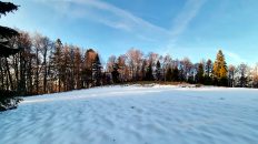
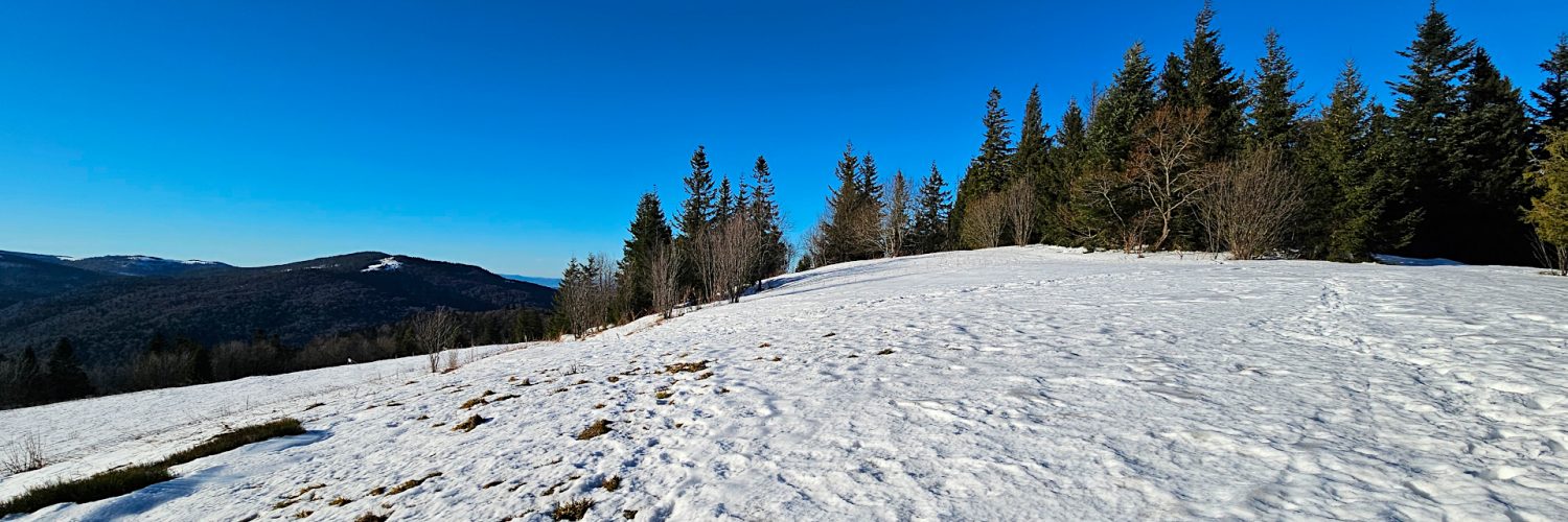
Gorc Kamienicki to rozległa, widokowa polana w Gorcach położona na wysokości 1040-1160 m n.p.m. Znajduje się na północnym grzbiecie Gorca, nieco poniżej jego wierzchołka. Z polany roztacza się rozległa panorama na Gorce, Beskid Wyspowy, Beskid Niski, Beskid Sądecki, Pieniny i Tatry. Na polanie znajduje się kilka szałasów. Na północno-zachodnim stoku znajduje się źródło wody pitnej „Do smoka”, a na wschodnim stoku źródło „U żłoba”. W okolicy polany swój początek mają potoki: Ustępny, Zasadne i Głębieniec. W północnej części polany znajduje się wierzchołek Czoło Gorca o wysokości 1160 m n.p.m. Dużą część polany porasta żyzna łąka mieczykowo-mietlicowa, wiosną obficie zakwita na niej śnieżyczka przebiśnieg.
Czoło Gorca – szczyt o wysokości 1160 m n.p.m. w odchodzącym na północ grzbiecie Gorca. Na południowych stokach rozciąga się widokowa polana Gorc Kamienicki. Północne stoki są zalesione i stromo opadają do doliny Potoku Głębieniec.
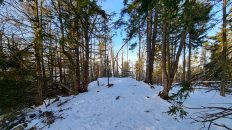
Gorce – pasmo górskie należące do Beskidów Zachodnich. Położone jest miedzy dolinami rzek Raba i Dunajec. Na północy graniczy z Beskidem Wyspowym, a na południu z Podhalem. Krajobraz Gorców stanowią rozchodzące się promieniście różnej długości grzbiety rozdzielone głęboko wciętymi dolinami o stromych zboczach. Szczególną wartość dla krajobrazu i przyrody Gorców mają polany reglowe. Powstały w wyniku tradycyjnej gospodarki pasterskiej. Znajdują się na nich liczne drewniane szałasy pasterskie reprezentujące regionalne budownictwo zagórzańskie i podhalańskie. Utworzony w 1981 roku Gorczański Park Narodowy chroni centralną część Gorców, obejmuje najmniej zmienione przez człowieka dolnoreglowe lasy mieszane, zwane buczyną karpacką. Najwyższe szczyty: Turbacz (1310 m), Jaworzyna Kamienicka (1288 m), Kiczora (1282 m), Kudłoń (1276 m), Czoło Turbacza (1259 m), Mostownica (1251 m), Gorc Troszacki (1235 m), Gorc (1228 m), Lubań (1225 m).
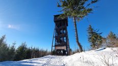
Gorc – szczyt o wysokości 1228 m n.p.m. położony we wschodniej części wielokilometrowego grzbietu głównego Gorców ciągnącego się aż od Turbacza. Jego charakterystyczna sylwetka z kilkoma polanami jest dobrze rozpoznawalna z dużych odległości. Zbudowany jest z grubych ławic piaskowców magurskich i zlepieńców. Północne stoki pokryte są dolnoreglowymi lasami jodłowo-bukowymi, wyższe partie górnoreglowym lasem świerkowym. Szczyt jest porośnięty przerzedzonym lasem, znajduje się na nim zbudowana w 2015 r. wieża widokowa. Z wieży roztacza się rozległa panorama z widokiem na Gorce, Tatry, Pieniny, Beskid Sądecki, Beskid Niski, Pogórze Rożnowskie i Beskid Wyspowy.
Z Gorca spływają liczne potoki zasilające Kamienicę lub Ochotnicę. Większe z nich to: Gorcowski Potok, Młynne, Zasadny Potok, Głębieniec, Ustępny, Spaleniec.
Film zarejestrowany w dniu 18 grudnia 2023 roku.