🇸🇰
🚶 Virtuálna prechádzka: Zostup z Paráča cez Príslopec do Hruštína, Slovensko
🏞️ Trasa: Hranica prírodnej rezervácie Paráč (1275 m n.m.; 49.322699, 19.217794) – Príslopec (1258 m n.m.; 49.316846, 19.241385) – Minčol (1139 m n.m.; 49.298985, 19.239495) – Vasiľovská hoľa, sedlo (1123 m n.m.; 49.297977, 19.241824) – Vasiľovská hoľa (1142 m n.m.; 49.290971, 19.247376) – Vasiľovská hoľa, chata (930 m n.m.; 49.290971, 19.247376)
🆔 Označenie chodníka: modrý chodník, žltý chodník
📏 Dĺžka: približne 6,5 km
⏲️ Čas chôdze: približne 2:00 h
↗️ Suma prístupov: 80 m
↘️ Zostup: 432 m
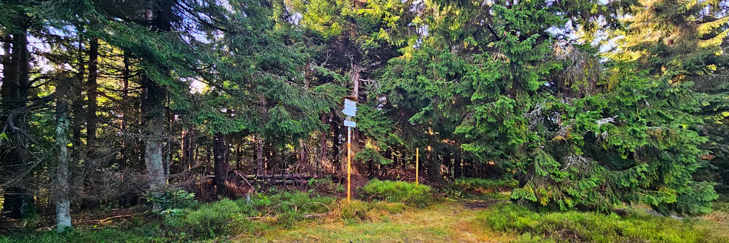
00:00:29 Hranica PR Paráč
00:33:11 Príslopec
00:46:58 Medvedia stopa
01:09:55 Minčol
01:14:20 Vasiľovská hoľa, sedlo
01:29:05 Vasiľovská hoľa
01:53:51 Vasiľovská hoľa, chata
Oravská Magura – pohorie vo Vonkajších Západných Karpatoch. Nachádza sa v severnej časti Slovenska, v historickom regióne Orava. Pohorie je súčasťou Stredných Beskýd. Najvyšším vrchom pohoria je Minčol, 1394 m n. m.
Pohorie sa nachádza medzi riekami Orava a jej prítokom Zázrivka a riekou Biela Orava na severe. Tiahne sa od juhozápadu k severovýchodu pásom širokým 5-10 km a dlhým 36 km. Rieka Biela Orava ich oddeľuje od Żywiec-Oravských Beskýd a Orava od Chočských vrchov a Skorusinských vrchov. Magura Oravská na juhozápade hraničí s Malou Fatrou a oddeľuje ju dolina potoka Zázrivka.
Oravská Magura sa delí na tri menšie celky:
- centrálna časť s pohorím Minčol (1394 m n.m.) a Kubínska hoľa (1346 m n.m.), známa ako Kubínska Hoľa;
- severná časť s vrchom Paráč (1325 m n.m.) a Príslopec (1258 m n.m.), známy ako pohorie Paráč;
- východná časť s Budínom (1222 m n.m.) a Magurkou (1107 m n.m.), známymi ako Budínske pohorie (Budínska Magura).
Príslopec – vrch s výškou 1258 m n.m. na Oravskej Magure na Slovensku. Nachádza sa v centrálnej časti pohoria, v geomorfologickej oblasti Paráč.
Príslopec sa nachádza na hrebeni vedúcom z Minčola (1394 m n.m.) severozápadným smerom na Paráč (1325 m n.m.). Na severe hraničí so Štíbeľom (1167 m n.m.) a Novým vrchom (1193 m n.m.), ktoré sú oddelené priesmykom, na východe s Držatínom (1136 m n.m.) a Feračovou (1044 m n.m.) a na juhu s Držatínom. (1136 m n.m.), Minčol (1139 m n.m.) a Bzinská hoľa (1195 m n.m.). Západné svahy sú prameňom Zázrivky, severovýchodný svah odvodňuje Lomnica a juhovýchodný svah Feračová, oba smerujú na Bielu Oravu.
Svahy a vrchol Príslopec sú pokryté lesom, no na východnom hrebeni je rozľahlý pasienok Držatín.
Video natočené 9. novembra 2023.
🇬🇧
The second part of the autumn hike in the Orava Magura. From the Paráč Nature Reserve, which protects the well-preserved original character of the upper montane spruce forest, we descend to the lower peak of Príslopec. The trail leads through the forest interspersed with small glades. At the crossroads on Príslopec, we head south along the ridge running through Minčol and Bzinská hoľa to Vasiľovská hoľa. Then we go down the extensive ski slope with views of the eastern part of the Orava Magura to the Vasiľovská hoľa ski station.
🚶 Virtual hike: Descent from Paráč through Príslopec to Hruštín, Slovakia
🏞️ Route: The border of the Paráč Nature Reserve (1275 m a.s.l.; 49.322699, 19.217794) – Príslopec (1258 m a.s.l.; 49.316846, 19.241385) – Minčol (1139 m a.s.l.; 49.298985, 19.239495) – Vasiľovská hoľa, sedlo (1123 m a.s.l.; 49.297977, 19.241824) – Vasiľovská hoľa (1142 m a.s.l.; 49.290971, 19.247376) – Vasiľovská hoľa, chata (930 m a.s.l.; 49.290971, 19.247376)
🆔 Trail designation: blue trail, yellow trail
📏 Length: about 6.5 km
⏲️ Walking time: about 2:00 h
↗️ Sum of approaches: 80 m
↘️ Sum down: 432 m
00:00:29 The border of the Paráč Nature Reserve
00:33:11 Príslopec
00:46:58 Bear footprint
01:09:55 Minčol
01:14:20 Vasiľovská hoľa, sedlo
01:29:05 Vasiľovská hoľa
01:53:51 Vasiľovská hoľa, chata
Orava Magura – a mountain range in the Outer Western Carpathians. It is located in the northern part of Slovakia, in the historical region of Orava. The range is part of the Central Beskids (Slovak: Stredné Beskydy). The highest peak of the range is Minčol, 1394 m a.s.l.
The range is located between the rivers Orava and its tributary Zázrivka, and the Biela Orava River in the north. It stretches from the south-west to the north-east with a strip 5-10 km wide and 36 km long. Biela Orava River separates them from the Żywiec-Orava Beskid Mountains, and Orava from the Choč Mountains and the Skorusina Mountains. In the south-west, Magura Oravska borders Mala Fatra Mountains and is separated by the valley of the Zázrivka stream.
Orava Magura is divided into three smaller units:
- the central part with Minčol Mountain (1394 m a.s.l.) and Kubínska Hoľa Mountain (1346 m a.s.l.), known as the Kubínska Hoľa range;
- the northern part with Paráč Mountain (1325 m a.s.l.) and Príslopec (1258 m a.s.l.), known as the Paráč range;
- the eastern part with Budín (1222 m a.s.l.) and Magurka (1107 m a.s.l.), known as the Budín range (Budínska Magura).
Príslopec – a peak with a height of 1258 m a.s.l. in the Orava Magura, Slovakia. It is located in the central part of the mountain range, in the Paráč geomorphological area.
Príslopec is located on a ridge leading from Minčol (1394 m a.s.l.) north-west to Paráč (1325 m a.s.l.). It borders on the north with Štíbeľ (1167 m a.s.l.) and Nový vrch (1193 m a.s.l.), separated by a pass, on the east with Držatín (1136 m a.s.l.) and Feračová (1044 m a.s.l.), and on the south with Držatín (1136 m a.s.l.), Minčol (1139 m a.s.l.) and Bzinská hoľa (1195 m a.s.l.). The western slopes are the source of Zázrivka, the northeastern slope is drained by Lomnica, and the southeastern slope by Feračová, both leading to Bilá Orava.
The slopes and top of Príslopec are covered with forest, but on the eastern ridge there is a large pasture called Držatín.
The film was recorded on November 9, 2023.


