
🇸🇰
🚶 Virtuálna prechádzka: Výstup na Paráč z Hruštína, Slovensko
🏞️ Trasa: Hruštín, Oravská horáreň (759 m n.m.; 49.307821, 19.301324) – Vstup na zelený chodník (1059 m n.m.; 49.321377, 19.280668) – Magurka (1128 m n.m.; 49.318951, 19.267740) – Príslopec (1258 m n.m.; 49.316846, 19.241385) – Hranica prírodnej rezervácie Paráč (1275 m n.m.; 49.322699, 19.217794)
🆔 Označenie chodníka: cesta vyznačená na mape, modrý chodník, zelený chodník
📏 Dĺžka: približne 7,5 km
⏲️ Čas chôdze: približne 3:00 h
↗️ Suma prístupov: 534 m
↘️ Zostup: 16 m
00:00:24 Hruštín, Oravská horáreň
00:45:01 Vstup na zelený chodník
01:02:43 Magurka
01:49:15 Príslopec
02:24:08 Hranica prírody Paráč Rezerva
Oravská Magura – pohorie vo Vonkajších Západných Karpatoch. Nachádza sa v severnej časti Slovenska, v historickom regióne Orava. Pohorie je súčasťou Stredných Beskýd. Najvyšším vrchom pohoria je Minčol, 1394 m n. m.
Pohorie sa nachádza medzi riekami Orava a jej prítokom Zázrivka a riekou Biela Orava na severe. Tiahne sa od juhozápadu k severovýchodu pásom širokým 5-10 km a dlhým 36 km. Rieka Biela Orava ich oddeľuje od Żywiec-Oravských Beskýd a Orava od Chočských vrchov a Skorusinských vrchov. Magura Oravská na juhozápade hraničí s Malou Fatrou a oddeľuje ju dolina potoka Zázrivka.
Oravská Magura sa delí na tri menšie celky:
- centrálna časť s pohorím Minčol (1394 m n.m.) a Kubínska hoľa (1346 m n.m.), známa ako Kubínska Hoľa;
- severná časť s vrchom Paráč (1325 m n.m.) a Príslopec (1258 m n.m.), známy ako pohorie Paráč;
- východná časť s Budínom (1222 m n.m.) a Magurkou (1107 m n.m.), známymi ako Budínske pohorie (Budínska Magura).
Paráč – vrch s výškou 1325 m n. m. v pohorí Oravská Magura na Slovensku, tretí najvyšší vrch tejto horskej skupiny, najvyšší v takzvanej Paráčovej skupine.
Paráč sa týči v centrálnej časti jeho skupiny na vysokom hrebeni smerujúcom z východu na západ. Nachádza sa medzi vrcholom Príslopec (1 258 m) na východe, cez ktorý sa jeho skupina spája s Kubínskou hoľou, a vrcholom Okrúhlica (1 165 m) na západe, cez ktorý sa spája s Oravskými Beskydami – a s. hlavný rozvodný hrebeň Karpát.
Masív Paráč je budovaný obrovskými vrstvami takzvaných magurských pieskovcov. Vrchol Paráča je mohutný a rozľahlý. Jej južné svahy strmo, trochu amfiteátrálne klesajú k pramenným tokom potoka Zázrivka. Severné svahy, menej strmé, sa nižšie delia na niekoľko väčších a menších chrbtov, prerezaných prvými pravobrežnými prítokmi Bielej Oravy. Samotná Biela Orava pramení na západných svahoch masívu Paracza, v nadmorskej výške približne 1 100 m.
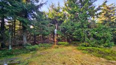
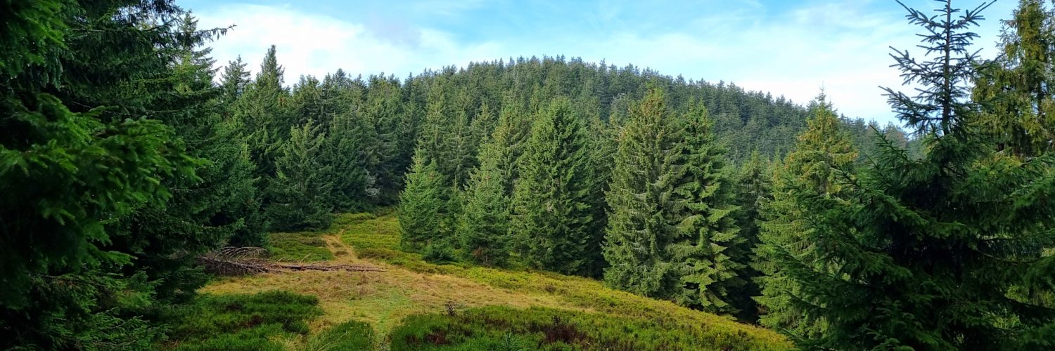
Celý masív Paráča vrátane samotného vrcholu je zalesnený. Na niektorých bočných hrebeňoch je len pár čistiniek. Vzhľadom na zachovalý pôvodný charakter horského smrekového lesa bol vrcholový dóm pohoria v roku 1980 chránený ako prírodná rezervácia Paráč.
Video natočené 9. novembra 2023.
🇬🇧
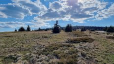
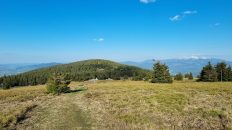
A scenic autumn hike in the Orava Magura. From Hruštín we ascend to Paráč. Initially, we walk along roads without a trail, enjoying the views of the Kubínska hoľa massif. We enter the forest and reach the green trail. Then we head west along the eastern ridge of Príslopec. We reach the peak of Magurka and behind it we enter a vast and scenic glade with distant views of the Żywiec-Orawa Beskid Mountains, the Wyspowy Beskids, the Gorce Mountains, the Tatra Mountains and the Little Fatra Mountains. We reach the next peak of Príslopec, where the trails intersect. Then we follow the blue trail to the border of the Paráč Nature Reserve. The peak itself lies off the trail in a protected area.
🚶 Virtual hike: Ascent to Paráč Mountain from Hruštín, Slovakia
🏞️ Route: Hruštín, Oravská horáreň (759 m a.s.l.; 49.307821, 19.301324) – Entrance to the green trail (1059 m a.s.l.; 49.321377, 19.280668) – Magurka (1128 m a.s.l.; 49.318951, 19.267740) – Príslopec (1258 m a.s.l.; 49.316846, 19.241385) – The border of the Paráč Nature Reserve (1275 m a.s.l.; 49.322699, 19.217794)
🆔 Trail designation: path marked on the map, green trail, blue trail
📏 Length: about 7.5 km
⏲️ Walking time: about 3:00 h
↗️ Sum of approaches: 534 m
↘️ Sum down: 16 m
00:00:24 Hruštín, Oravská horáreň
00:45:01 Entrance to the green trail
01:02:43 Magurka
01:49:15 Príslopec
02:24:08 The border of the Paráč Nature Reserve
Orava Magura – a mountain range in the Outer Western Carpathians. It is located in the northern part of Slovakia, in the historical region of Orava. The range is part of the Central Beskids (Slovak: Stredné Beskydy). The highest peak of the range is Minčol, 1394 m a.s.l.
The range is located between the rivers Orava and its tributary Zázrivka, and the Biela Orava River in the north. It stretches from the south-west to the north-east with a strip 5-10 km wide and 36 km long. Biela Orava River separates them from the Żywiec-Orava Beskid Mountains, and Orava from the Choč Mountains and the Skorusina Mountains. In the south-west, Magura Oravska borders Mala Fatra Mountains and is separated by the valley of the Zázrivka stream.
Orava Magura is divided into three smaller units:
- the central part with Minčol Mountain (1394 m a.s.l.) and Kubínska Hoľa Mountain (1346 m a.s.l.), known as the Kubínska Hoľa range;
- the northern part with Paráč Mountain (1325 m a.s.l.) and Príslopec (1258 m a.s.l.), known as the Paráč range;
- the eastern part with Budín (1222 m a.s.l.) and Magurka (1107 m a.s.l.), known as the Budín range (Budínska Magura).
Paráč – a peak with a height of 1325 m a.s.l. in the Orava Magura Mountains in Slovakia, the third highest peak in this mountain group, the highest in the so-called Paráč Group.
Paráč rises in the central part of its group, on a high ridge running east-west. It is located between the Príslopec peak (1,258 m) in the east, through which its group connects with the Kubínska hoľa Range, and the Okrúhlica peak (1,165 m) in the west, through which it connects with the Orava Beskids – and with the main watershed ridge of the Carpathians.
The Paráč Massif is built of huge layers of so-called sandstones Magura. The top of Paráč is massive and spreading. Its southern slopes descend steeply, somewhat amphitheaterally, towards the source watercourses of the Zázrivka stream. The northern slopes, less steep, divide lower into several larger and smaller ridges, cut by the first right-bank tributaries of the White Orava. The White Orava itself has its source on the western slopes of the Paracza massif, at an altitude of approximately 1,100 m.
The entire Paráč massif, including the peak itself, is forested. There are only a few clearings on some side ridges. Due to the well-preserved original character of the upper montane spruce forest, the peak dome of the mountain was protected in 1980 as the Paráč Nature Reserve.
The film was recorded on November 9, 2023.