
🇵🇱
🚶 Wirtualna wędrówka: Zejście z Magury Małastowskiej przez Sołtysią Górę do Owczar, Polska
🏞️ Trasa: Magura Małastowska (813 m n.p.m.; 49.553390, 21.219549) – Wierch (705 m n.p.m.; 49.568389, 21.178851) – Szczyt bez nazwy (670 m n.p.m.; 49.572799, 21.163112) – Sołtysia Góra (600 m n.p.m.; 49.584026, 21.151192) – Owczary – Kozylów (387 m n.p.m.; 49.593611, 21.173680)
🆔 Oznaczenie: zielony szlak, drogi oznaczone na mapie
📏 Długość: około 9,7 km
⏲️ Czas przejścia: około 3:00 h
↗️ Suma podejść: 58 m
↘️ Suma zejść: 497 m
00:00:23 Magura Małastowska
00:53:44 Zejście ze szlaku
00:56:48 Wierch
01:01:24 Powrót na zielony szlak
01:16:36 Szczyt bez nazwy
01:43:14 Sołtysia Góra
01:53:20 Zejście ze szlaku
02:09:01 Potok
02:14:49 Potok
02:16:17 Potok
02:19:36 Potok
02:29:53 Owczary – Kozylów
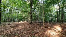
Sołtysia Góra – dwuwierzchołkowy szczyt w Beskidzie Niskim położony w północnym ramieniu Pasma Magury Małastowskiej. Południowy wierzchołek ma wysokość 600 m n.p.m. a północny 598 m n.p.m.
Wierzchowina szczytowa jest dość płaska, stoki średnio strome, porozcinane dolinkami drobnych cieków wodnych. Na południowo-zachodnich stokach Sołtysiej Góry, wysoko (ok. 550 m n.p.m.), znajdują się źródliska potoku Bielanka, natomiast stokami północnymi i wschodnimi spływają lewobrzeżne dopływy potoku Siarka. Szczyt jest w całości porośnięty lasem. Przez południowy wierzchołek przebiega zielony szlak turystyczny im. Wincentego Pola.
Beskid Niski – pasmo górskie w Karpatach między przełęczami Łupkowską na wschodzie a Tylicką na zachodzie. Wschodnia granica Beskidu Niskiego jest zarazem granicą Karpat Wschodnich i Zachodnich. Od wschodu graniczy z Bieszczadami, od północnego wschodu z Pogórzem Bukowskim, od zachodu z Kotliną Sądecką, od południowego zachodu z Beskidem Sądeckim, a od północy z Pogórzem Środkowobeskidzkim.
Najwyższy szczyt po polskiej stronie to Lackowa (997 m n.p.m.), a po słowackiej Busov (1002 m n.p.m.), który jako jedyny przekracza 1000 m. Ważniejsze rzeki to Osławica, Wisłok, Jasiołka, Wisłoka, Ropa i Biała Dunajcowa, należą do zlewni Morza Bałtyckiego.
W centrum Beskidu Niskiego znajduje się Magurski Park Narodowy, a we wschodniej części Jaśliski Park Krajobrazowy. Beskid Niski jest najniższą a zarazem najrozleglejszą częścią Beskidów i całego łuku Karpat.
Beskid Niski dzieli się na: Góry Grybowskie, Góry Hańczowskie, Beskid Gorlicki, Pasmo Magurskie, Beskid Dukielski, Pasmo Bukowicy i Kamienia, Gniazdo Jawornika, Pasmo graniczne, Wzgórza Rymanowskie.
Beskid Niski zbudowany jest ze skał osadowych zwanych fliszem karpackim. Są to najczęściej naprzemiennie ułożone ławice zlepieńców, piaskowców i łupków ilastych. Najniższa jest płaszczowina śląska, środkowa – dukielska, a najwyższa – magurska. Wychodnie piaskowców magurskich często mają postać fantastycznych form skalnych. Najbardziej znane są Kornuty na Magurze Wątkowskiej i Diabli Kamień koło Folusza. Występuje też wiele jaskiń. Największe ich skupiska to Kilanowska Góra k. Lipowicy (około 70 jaskiń) oraz Cergowa (11 jaskiń). Znana jest Jaskinia Mroczna w Kornutach, której łączna długość korytarzy sięga prawie 200 m, a głębokość 15,5 metrów.
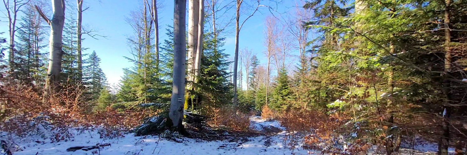
W Beskidzie Niskim występują tylko dwa piętra roślinne: pogórza (do 550 m n.p.m.) i regiel dolny. Piętro pogórza tworzą pozostałości pierwotnych lasów dębowo – grabowych, olszy i zarośla wikliny w dolinach rzek, natomiast regiel dolny to lasy jodłowe, bukowe i sosnowe. Szczególnie liczne są drzewostany bukowe, a świerk jest niemal nieobecny.
Film zarejestrowany w dniu 29 marca 2023 roku.