
🇵🇱
🚶 Wirtualna wędrówka: Wejście na Magurę Małastowską z Owczar, Polska
🏞️ Trasa: Owczary, Cerkiew Opieki Matki Bożej (414 m n.p.m.; 49.588521, 21.191168) – Przełęcz Owczarska (501 m n.p.m.; 49.581625, 21.219251) – Ostry Dział (675 m n.p.m.; 49.570435, 21.215168) – Magura Małastowska (813 m n.p.m.; 49.553390, 21.219549)
🆔 Oznaczenie: droga oznaczona na mapie, niebieski szlak
📏 Długość: około 5,9 km
⏲️ Czas przejścia: około 2:00 h
↗️ Suma podejść: 409 m
↘️ Suma zejść: 10 m
00:00:22 Owczary, Cerkiew Opieki Matki Bożej
00:03:25 Kapliczka
00:03:51 Potok Siarka
00:11:11 Potok Siarka
00:15:41 Potok Siarka
00:21:38 Potok Siarka
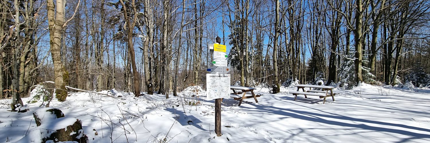
00:34:54 Przełęcz Owczarska
01:01:24 Ostry Dział
01:46:29 Magura Małastowska
Beskid Niski – pasmo górskie w Karpatach między przełęczami Łupkowską na wschodzie a Tylicką na zachodzie. Wschodnia granica Beskidu Niskiego jest zarazem granicą Karpat Wschodnich i Zachodnich. Od wschodu graniczy z Bieszczadami, od północnego wschodu z Pogórzem Bukowskim, od zachodu z Kotliną Sądecką, od południowego zachodu z Beskidem Sądeckim, a od północy z Pogórzem Środkowobeskidzkim.
Najwyższy szczyt po polskiej stronie to Lackowa (997 m n.p.m.), a po słowackiej Busov (1002 m n.p.m.), który jako jedyny przekracza 1000 m. Ważniejsze rzeki to Osławica, Wisłok, Jasiołka, Wisłoka, Ropa i Biała Dunajcowa, należą do zlewni Morza Bałtyckiego.
W centrum Beskidu Niskiego znajduje się Magurski Park Narodowy, a we wschodniej części Jaśliski Park Krajobrazowy. Beskid Niski jest najniższą a zarazem najrozleglejszą częścią Beskidów i całego łuku Karpat.
Beskid Niski dzieli się na: Góry Grybowskie, Góry Hańczowskie, Beskid Gorlicki, Pasmo Magurskie, Beskid Dukielski, Pasmo Bukowicy i Kamienia, Gniazdo Jawornika, Pasmo graniczne, Wzgórza Rymanowskie.
Beskid Niski zbudowany jest ze skał osadowych zwanych fliszem karpackim. Są to najczęściej naprzemiennie ułożone ławice zlepieńców, piaskowców i łupków ilastych. Najniższa jest płaszczowina śląska, środkowa – dukielska, a najwyższa – magurska. Wychodnie piaskowców magurskich często mają postać fantastycznych form skalnych. Najbardziej znane są Kornuty na Magurze Wątkowskiej i Diabli Kamień koło Folusza. Występuje też wiele jaskiń. Największe ich skupiska to Kilanowska Góra k. Lipowicy (około 70 jaskiń) oraz Cergowa (11 jaskiń). Znana jest Jaskinia Mroczna w Kornutach, której łączna długość korytarzy sięga prawie 200 m, a głębokość 15,5 metrów.
W Beskidzie Niskim występują tylko dwa piętra roślinne: pogórza (do 550 m n.p.m.) i regiel dolny. Piętro pogórza tworzą pozostałości pierwotnych lasów dębowo – grabowych, olszy i zarośla wikliny w dolinach rzek, natomiast regiel dolny to lasy jodłowe, bukowe i sosnowe. Szczególnie liczne są drzewostany bukowe, a świerk jest niemal nieobecny.
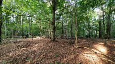
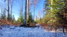
Magura Małastowska – szczyt o wysokości 813 m n.p.m. w Beskidzie Niskim, w południowo-wschodniej części grzbietu pasma Magury Małastowskiej. Sam szczyt, jak i całe pasmo Magury Małastowskiej są zalesione. Rozległe widoki roztaczają się z Przełęczy Owczarskiej, położonej około 3,5 km na północ od wierzchołka. U podnóży góry mają swe źródła trzy niewielkie potoki: Przysłup, Siarka oraz Krzywy.
Na zboczach Magury Małastowskiej znajdują się pamiątki po przebiegającej jej zboczami podczas I wojny światowej linii frontu austriacko-rosyjskiego: okopy, umocnione stanowiska ogniowe, pozostałości ziemianek oraz trzy cmentarze, zaprojektowane przez słowackiego architekta, Dušana Jurkoviča. W pobliżu szczytu zbudowano cmentarz nr 58.
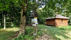
Na południowy-wschód od wierzchołka Magury Małastowskiej, na wysokości ok. 740 m n.p.m. znajduje się schronisko turystyczne PTTK, a na wschodnich zboczach w zimie działa ośrodek narciarski Magura Ski Park.
Przełęcz Owczarska – przełęcz na wysokości 501 m n.p.m. w północno-zachodniej części Beskidu Niskiego, położona pomiędzy szczytami Brusów (594 m n.p.m.) oraz Ostrego Działu (675 m n.p.m.). Przez przełęcz biegnie stara droga, łącząca Owczary z Małastowem oraz poprowadzony jest niebieski szlak turystyczny Szalowa – Schronisko PTTK w Bartnem.
Film zarejestrowany w dniu 29 marca 2023 roku.
🇬🇧
Spring-winter hiking in the Low Beskid Mountains. From Owczary we ascend Magura Małastowska, the highest peak of the Magura Małastowska Range. We start at the Church of the Protection of the Mother of God in Owczary, from where we reach the beautiful, scenic Owczary Pass. From the pass, we follow the blue trail first ascend to Ostry Dział and then to Magura Małastowska. Through thinned trees without leaves, we can admire beautiful views of Magura, Wierch and Sołtysia Góra.
🚶 Virtual hike: Ascent to Magura Małastowska Mountain from Owczary, Poland
🏞️ Route: Owczary, Church of the Protection of the Mother of God (414 m a.s.l.; 49.588521, 21.191168) – Owczary Pass (501 m a.s.l.; 49.581625, 21.219251) – Ostry Dział Mountain (675 m a.s.l.; 49.570435, 21.215168) – Magura Małastowska Mountain (813 m a.s.l.; 49.553390, 21.219549)
🆔 Trail designation: roads marked on the map, blue trail
📏 Length: about 5.9 km
⏲️ Walking time: about 2:00 h
↗️ Sum of approaches: 409 m
↘️ Sum down: 10 m
00:00:22 Owczary, Church of the Protection of the Mother of God
00:03:25 Chapel
00:03:51 Siarka Stream
00:11:11 Siarka Stream
00:15:41 Siarka Stream
00:21:38 Siarka Stream
00:34:54 Owczary Pass
01:01:24 Ostry Dział Mountain
01:46:29 Magura Małastowska Mountain
Low Beskid Mountains – a mountain range in the Carpathian Mountains between the Łupkowska Pass in the east and the Tylicz Pass in the west. The eastern border of the Low Beskids is also the border of the Eastern and Western Carpathians. From the east it borders with the Bieszczady Mountains, from the north-east with the Bukowskie Foothills, from the west with the Sącz Valley, from the south-west with the Sącz Beskid Mountains, and from the north with the Środkowobeskidzkie Foothills.
The highest peak on the Polish side is Lackowa (997 m a.s.l.), and on the Slovak side Busov (1002 m a.s.l.), which is the only one that exceeds 1000 m.
In the center of the Low Beskids there is the Magurski National Park, and in the eastern part of the Jaśliska Landscape Park. The Low Beskids are the lowest and at the same time the most extensive part of the Beskids and the entire arc of the Carpathians.
The Low Beskids are divided into: the Grybów Mountains, the Hańczowa Mountains, the Gorlice Beskids, the Magura Range, the Dukiel Beskids, the Bukowica and Stone Range, Jawornik’s Nest, the Border Range, and the Rymanów Hills.
The Low Beskids are made of sedimentary rocks called the Carpathian flysch. These are usually alternating beds of conglomerates, sandstones and shales. The lowest is the Silesian Nappe, the middle one is the Dukla Nappe, and the highest one is the Magura Nappe. Magura sandstone outcrops often take the form of fantastic rock formations. The most famous are Kornuty on Magura Wątkowska and Diabli Kamień near Folusz. There are also many caves. The largest clusters of them are Kilanowska Góra near Lipowica (about 70 caves) and Cergowa (11 caves). The Mroczna Cave in Kornuty is well-known, the total length of its corridors reaches almost 200 m, and the depth is 15.5 meters.
In the Low Beskids there are only two vegetation levels: the foothills (up to 550 m a.s.l.) and the lower mountain forest. The foothills are made up of the remains of original oak and hornbeam forests, alders and wicker thickets in the river valleys, while the lower montane forests are fir, beech and pine forests. Beech stands are particularly numerous, and spruce is almost absent.
Magura Małastowska – a peak with a height of 813 m a.s.l. in the Low Beskid Mountains, in the south-eastern part of the ridge of the Magura Małastowska range. The peak itself, as well as the entire Magura Małastowska range, are forested. Extensive views extend from Owczary Pass, located about 3.5 km north of the top. Three small streams have their sources at the foot of the mountain: Przysłup, Siarka and Krzywy.
On the slopes of Magura Małastowska there are memorabilia of the Austro-Russian front line running along its slopes during World War I: trenches, fortified firing positions, remains of dugouts and three cemeteries, designed by the Slovak architect Dušan Jurkovič. Cemetery No. 58 was built near the top.
To the south-east of the top of Magura Małastowska, at an altitude of approx. 740 m a.s.l. there is a PTTK tourist shelter, and the Magura Ski Park ski resort operates on the eastern slopes in winter.
Owczary Pass – a pass at an altitude of 501 m a.s.l. in the north-western part of the Low Beskid Mountains, located between the peaks of Brusy (594 m a.s.l.) and Ostry Dział (675 m a.s.l.). An old road runs through the pass, connecting Owczary with Małastów, and there is a blue tourist trail from Szalowa to PTTK Hostel in Bartne.
The film was recorded on March 29, 2023.