
🇵🇱
🚶 Wirtualna wędrówka: wejście na Patrol, Trupień, Zieloną i Pruskową w Zgórskich Górach, Polska
🏞️ Trasa: Zagrody, parking (281 m n.p.m.; 50.831343, 20.515624) – Skrzyżowanie pod Patrolem (379 m n.p.m.; 50.840595, 20.515497) – Patrol (388 m n.p.m.; 50.839621, 20.518676) – Trupień (365 m n.p.m.; 50.835578, 20.528356) – Słowik-Willa (246 m n.p.m.; 50.836522, 20.534917) – Zalesie, ul. Garbarska (255 m n.p.m.; 50.842595, 20.535478) – Skrzyżowanie pod Patrolem (379 m n.p.m.; 50.840595, 20.515497) – Zielona (378 m n.p.m.; 50.843301, 20.507743) – Pruskowa (383 m n.p.m.; 50.846350, 20.498820) – Szewce, Miejsce Pamięci Partyzantów (273 m n.p.m.; 50.834230, 20.497602)
🆔 Oznaczenie: niebieski szlak, czarny szlak, żółty szlak spacerowy
📏 Długość: około 8,6 km
⏲️ Czas przejścia: około 2:40 h
↗️ Suma podejść: 286 m
↘️ Suma zejść: 290 m
00:00:20 Zagrody, parking
00:03:51 Krzyż
00:20:50 Skrzyżowanie pod Patrolem
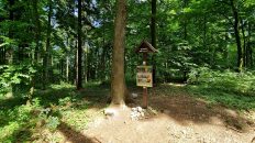
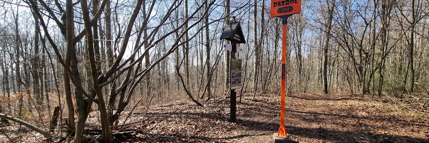
00:24:53 Patrol
00:34:39 Krzyż
00:40:28 Trupień
00:51:20 Słowik-Willa
01:02:45 Zalesie, ul. Garbarska
01:08:23 Kapliczka
01:08:49 Potok
01:12:45 Potok
01:15:46 Potok
01:20:04 Potok
01:26:22 Źródełko
01:33:30 Skrzyżowanie pod Patrolem
01:44:42 Zejście ze szlaku
01:45:52 Zielona
01:47:52 Skrzyżowanie niebieskiego i czarnego szlaku
01:52:12 Zejście ze szlaku
01:58:16 Pruskowa
02:04:50 Powrót na niebieski szlak
02:18:17 Potok
02:19:25 Szewce, Miejsce Pamięci Partyzantów
02:19:51 Krzyż
02:21:38 Kapliczka
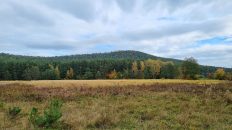
Góry Świętokrzyskie – pasmo górskie leżące w centralnej Polsce na Wyżynie Kieleckiej. To jedno z najstarszych łańcuchów górskich w Europie. Najwyższym szczytem jest Łysica (614 m n.p.m.) w paśmie Łysogór. Krajobraz gór stanowią strome stoki, głęboko wcięte doliny, skałki ostańcowe i gołoborza. Góry Świętokrzyskie porośnięte są lasami jodłowymi (Puszcza Jodłowa) i bukowymi.
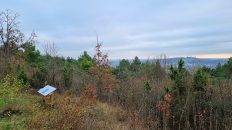
Zgórskie Góry (Pasmo Zgórskie) – pasmo ośmiu szczytów w Górach Świętokrzyskich rozciągające się od Rykoszyna na zachodzie po przedmieścia Kielc-Słowika, na wschodzie. Licząc od zachodu są to szczyty: Ciastowa (329 m), Plebańska (342 m), Skwarnia (317 m), Belnia (362 m), Pruskowa (383 m), Zielona (378 m), Patrol (388 m), Trupień (365 m). Masyw zbudowany jest z oliwkowo – szarych piaskowców i porasta go las mieszany, z bardzo dużą przewagą buczyny. Cechą charakterystyczną tego pasma jest niespotykana gdzie indziej w Górach Świętokrzyskich duża ilość pięknych, głębokich wąwozów i bocznych dolinek. Najlepiej widoczne są w całości, kiedy liście opadną z drzew. Najwyższym szczytem Pasma Zgórskiego jest Patrol, wzniesienie o wysokości 388 m n.p.m.
Patrol – najwyższy szczyt Pasma Zgórskiego w Górach Świętokrzyskich, wznosi się na wysokość 388 m n.p.m. Położony jest w jego wschodniej części tego pasma. Północne stoki poprzecinane są strumieniami tworzącymi malownicze wąwozy. Południowe i wschodnie stoki opadają do miejscowości Zagrody. Od zachodu Patrol graniczy ze szczytem Zielona, od wschodu ze szczytem Trupień. Wierzchołek i stoki Patrola porasta las mieszany z dużą przewagą buka.
Pruskowa – drugi co do wysokości szczyt Pasma Zgórskiego w Górach Świętokrzyskich, wznosi się na wysokość 383 m n.p.m. Od wschodu sąsiaduje ze szczytem Zielona, od zachodu oddzielny jest przełęczą Pod Belnią od szczytu Belnia. Północne stoki rozcina malowniczy strumyk Biała Woda, południowe stoki opadają do miejscowości Szewce. Szczyt i zbocza porośnięte są lasem mieszanym z dużą przewagą buka.
Zielona – trzeci co do wysokości szczyt Pasma Zgórskiego w Górach Świętokrzyskich, wznosi się na wysokość 372 m n.p.m. Od wschodu przez płytką przełęcz sąsiaduje ze szczytem Patrol, od zachodu sąsiaduje ze szczytem Pruskowa. Północne i południowe stoki porozcinane są malowniczymi wąwozami przez które spływają niewielkie strumienie. Szczyt i zbocza porośnięte są lasem mieszanym z dużą przewagą buka. W pobliżu szczytu krzyżują się niebieski i czarny szlak turystyczny.
Trupień – czwarty co do wysokości szczyt Pasma Zgórskiego w Górach Świętokrzyskich, wznosi się na wysokość 365 m n.p.m. Od wschodu strome stoki opadają do kieleckiego osiedla Słowik-Willa, od zachodu graniczy ze szczytem Patrol. Północne i południowe stoki porozcinane są malowniczymi wąwozami przez które spływają niewielkie strumienie. Szczyt i zbocza porośnięte są lasem mieszanym z dużą przewagą buka. Przez szczyt prowadzi niebieski szlak turystyczny z Chęcin do Łagowa.
Film zarejestrowany w dniu 8 marca 2024 roku.
🇬🇧
Spring hike in the Świętokrzyskie Mountains. From the village of Zagrody near Kielce, we hike through the Zgórskie Range, also called the Zgórskie Góry, which has a large number of beautiful gorges, not found elsewhere in the Świętokrzyskie Mountains. Initially, we follow the red trail to the intersection under Patrol, and then we reach Patrol – the highest peak of the Zgórskie Range. Then we head east along the blue trail and reach another peak, Trupień. We go down the gorge to the village of Zalesie. We go the yellow walking trail around Trupień and take the red trail from the other side to the intersection near Patrol. The trail leads here through a beautiful gorge cut by numerous streams. At the intersection we join the blue trail and conquer two more peaks: Zielona and Pruskowa. We descend to the village of Szewce to the Partisan Memorial Monument.
🚶 Virtual hike: ascent to Patrol, Trupień, Zielona and Pruskowa hills in the Zgórskie Range, Poland
🏞️ Route: Zagrody, parking (281 m a.s.l.; 50.831343, 20.515624) – Crossroads at Patrol (379 m a.s.l.; 50.840595, 20.515497) – Patrol Hill (388 m a.s.l.; 50.839621, 20.518676) – Trupień Hill (365 m a.s.l.; 50.835578, 20.528356) – Słowik-Willa (246 m a.s.l.; 50.836522, 20.534917) – Zalesie, Garbarska Street (255 m a.s.l.; 50.842595, 20.535478) – Crossroads at Patrol (379 m a.s.l.; 50.840595, 20.515497) – Zielona Hill (378 m a.s.l.; 50.843301, 20.507743) – Pruskowa Hill (383 m a.s.l.; 50.846350, 20.498820) – Szewce, Partisan Memorial Site (273 m a.s.l.; 50.834230, 20.497602)
🆔 Trail designation: blue trail, red trail, yellow walking trail
📏 Length: about 8.6 km
⏲️ Walking time: about 2:40 h
↗️ Sum of approaches: 286 m
↘️ Sum down: 290 m
00:00:20 Zagrody, parking
00:03:51 Cross
00:20:50 Crossroads at Patrol
00:24:53 Patrol Hill
00:34:39 Cross
00:40:28 Trupień Hill
00:51:20 Słowik-Willa
01:02:45 Zalesie, Garbarska Street
01:08:23 Chapel
01:08:49 Stream
01:12:45 Stream
01:15:46 Stream
01:20:04 Stream
01:26:22 Spring
01:33:30 Crossroads at Patrol
01:44:42 Going off the trail
01:45:52 Zielona Hill
01:47:52 Crossing of the blue and the black trails
01:52:12 Going off the trail
01:58:16 Pruskowa Hill
02:04:50 Return to the blue trail
02:18:17 Stream
02:19:25 Szewce, Partisan Memorial Site
02:19:51 Cross
02:21:38 Chapel
Świętokrzyskie Mountains – a mountain range located in central Poland on the Kielce Upland. It is one of the oldest mountain ranges in Europe. The highest peak is Łysica (614 m a.s.l.) in the Łysogór range. The landscape of the mountains consists of steep slopes, deeply indented valleys, inselberg rocks and stone runs. The Świętokrzyskie Mountains are covered with fir (Puszcza Jodłowa) and beech forests.
Zgórskie Góry (Zgórskie Range) – a range of eight peaks in the Świętokrzyskie Mountains stretching from Rykoszyn in the west to the suburbs of Kielce-Słowik in the east. Counting from the west, these are the peaks: Ciastowa (329 m), Plebańska (342 m), Skwarnia (317 m), Belnia (362 m), Pruskowa (383 m), Zielona (378 m), Patrol (388 m), Trupień (365 m). The massif is made of olive-gray sandstones and is covered with mixed forest, with a very large predominance of beech forest. A characteristic feature of this range is a large number of beautiful, deep gorges and side valleys, found nowhere else in the Świętokrzyskie Mountains. They are best visible in their entirety when the leaves fall from the trees. The highest peak of the Zgórskie Range is Patrol, a hill 388 m above sea level.
Patrol Hill – the highest peak of the Zgórskie Range in the Świętokrzyskie Mountains, rising to a height of 388 m a.s.l. It is located in the eastern part of this range. The northern slopes are cut by streams creating picturesque gorges. The southern and eastern slopes descend to the village of Zagrody. From the west, Patrol borders the Zielona peak, from the east by the Trupień peak. The top and slopes of Patrol are covered with mixed forest with a large predominance of beech.
Pruskowa Hill – the second highest peak of the Zgórskie Range in the Świętokrzyskie Mountains, rising to a height of 383 m a.s.l. From the east it is adjacent to the Zielona peak, from the west it is separated from the Belnia peak by the Pod Belnią pass. The northern slopes are cut by the picturesque Biała Woda stream, the southern slopes descend to the village of Szewce. The peak and slopes are covered with mixed forest, with a large predominance of beech.
Zielona Hill – the third highest peak of the Zgórskie Range in the Świętokrzyskie Mountains, rising to a height of 372 m a.s.l. From the east, through a shallow pass, it is adjacent to the Patrol peak, and from the west it is adjacent to the Pruskowa peak. The northern and southern slopes are cut by picturesque gorges through which small streams flow. The peak and slopes are covered with mixed forest, with a large predominance of beech. The blue and black hiking trails intersect near the peak.
Trupień Hill – the fourth highest peak of the Zgórskie Range in the Świętokrzyskie Mountains, rises to a height of 365 m a.s.l. From the east, steep slopes descend to the Słowik-Willa estate in Kielce, and from the west, it is bordered by the Patrol peak. The northern and southern slopes are cut by picturesque gorges through which small streams flow. The peak and slopes are covered with mixed forest, with a large predominance of beech. The blue tourist trail from Chęciny to Łagów runs through the peak.
The film was recorded on March 8, 2024.