
🇵🇱
🚶 Wirtualna wędrówka: Wejście na Babią Górę z Polany Stańcowej, Polska
🏞️ Trasa: Polana Stańcowa (878 m n.p.m.; 49.544906, 19.540697) – Granica Babiogórskiego Parku Narodowego (1267 m n.p.m.; 49.561412, 19.543240) – Ruiny schroniska na Babiej Górze (1616 m n.p.m.; 49.570681, 19.532635) – Źródło Głodna Woda (1633 m n.p.m.; 49.570789, 19.531873) – Babia Góra, Diablak (1725 m n.p.m.; 49.573087, 19.529446)
🆔 Oznaczenie: zielony szlak
📏 Długość: około 4,7 km
⏲️ Czas przejścia: około 2:30 h
↗️ Suma podejść: 841 m
↘️ Suma zejść: 0 m
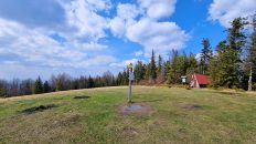
00:00:23 Polana Stańcowa
00:01:16 Lipniczanka
00:03:04 Skrzyżowanie zielonego i niebieskiego szlaku
00:27:45 Potok
00:31:23 Potok
00:35:42 Potok
00:49:06 Granica Babiogórskiego Parku Narodowego
01:32:48 Ruiny schroniska na Babiej Górze
01:36:49 Źródło Głodna Woda
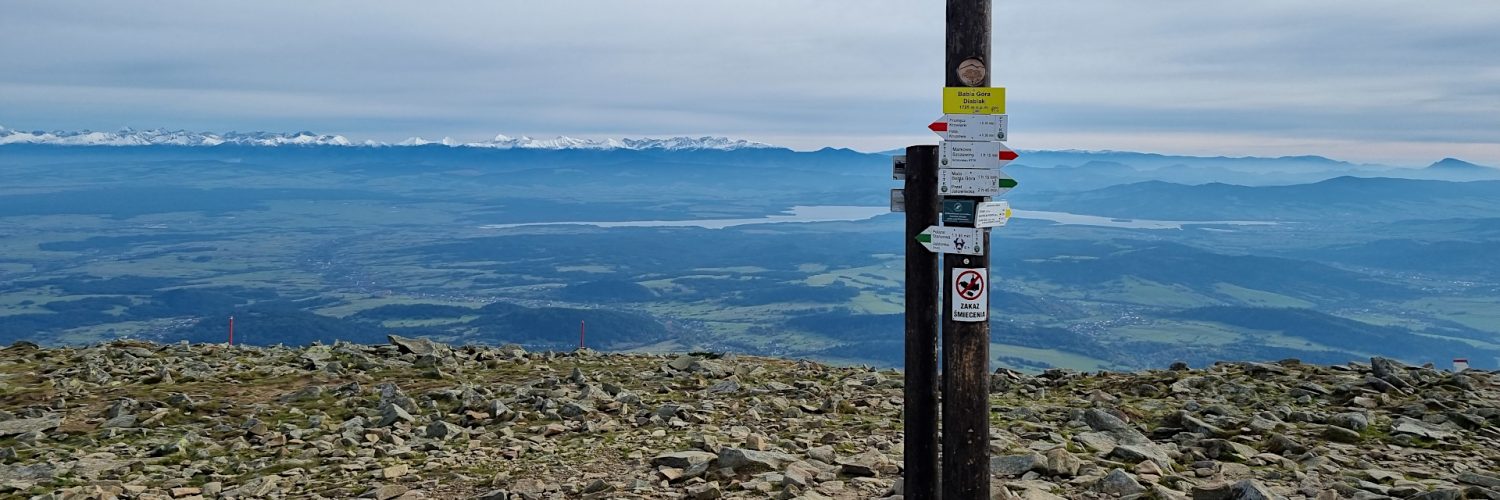
01:49:09 Babia Góra, Diablak
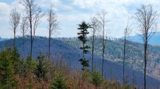
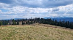
Beskid Żywiecko-Orawski – drugie co do wysokości pasmo górskie w Polsce, będące częścią Beskidów Zachodnich. Krajobraz Beskidu Żywieckiego tworzą kopulaste szczyty z piętrowym układem roślinności, obejmującym regiel górny i środkowy, porośnięte buczyną, dębem, świerkiem, sosną i jodłą oraz kosodrzewiną w najwyższych partiach.
Babia Góra lub Diablak – najwyższy szczyt Beskidu Żywiecko-Orawskiego o wysokości 1725 m n.p.m. i jednocześnie najwyższe wzniesienie Beskidów Zachodnich. Stanowi jednolity i odosobniony masyw o przebiegu równoleżnikowym. Charakterystyczna, z daleka już rozpoznawalna sylweta góry ze stromymi stokami północnymi i połogami, na dużych obszarach wypłaszczonymi stokami południowymi, jest wynikiem budowy geologicznej masywu. Od północy graniczy z doliną Skawicy a od południa z Działami Orawskimi. Wschodnie krańce masywu wyznacza przełęcz Lipnicka, a zachodnie przełęcz Jałowiecka.
Wraz ze wzrostem wysokości zmieniają się warunki klimatyczne. Powodują one pionowe zróżnicowanie szaty roślinnej. Pozwala to na wyróżnienie na Babiej Górze pięter klimatyczno-roślinnych odpowiadającym analogicznym piętrom występującym w górach wysokich np. Tatrach, Alpach, lecz w stosunku do nich obniżonych o kilkaset metrów.
Szczytowe partie Diablaka pokrywa rumowisko skalne zwane rumowiskiem Babiej Góry. W podszczytowych partiach, w miejscu zwanym Orawskimi Piwnicami, znajduje się największe nagromadzenie jaskiń po słowackiej stronie Babiej Góry. Na południowych stokach góry, około 10 min. drogi poniżej szczytu, znajduje się nigdy nie wysychające i najwyżej w całych polskich Beskidach położone źródło wody – Głodna Woda. Poniżej tego źródła znajdują się ruiny dawnego schroniska na Babiej Górze.
Film zarejestrowany w dniu 5 października 2022 roku.
🇬🇧
Autumn hiking in the Żywiec-Orawa Beskid Mountains. From the Stańcowa Glade we follow the green trail to Babia Góra Mountain. Initially, we go through the forest, reaching a picturesque stream flowing from the slopes of Babia Góra. A little further, we reach the border of the Babia Góra National Park, from where the Panski Pavement leads to the top. After passing the upper border of the forest, fantastic views of the Tatras are revealed. Before the summit, we visit the ruins of the former shelter, pass the Głodna Woda spring and at the very top we admire the amazing panorama of the Beskids, the Tatra Mountains, the Choč Mountains, the Great and the Little Fatra Mountains, and even Krakow can be seen in the distance.
🚶 Virtual hike: Ascent to Babia Góra from Stańcowa Glade, Poland
🏞️ Route: Stańcowa Glade (878 m a.s.l.; 49.544906, 19.540697) – The border of the Babia Góra National Park (1267 m a.s.l.; 49.561412, 19.543240) – The ruins of the mountain shelter on Babia Góra (1616 m a.s.l.; 49.570681, 19.532635) – Głodna Woda Source (1633 m a.s.l.; 49.570789, 19.531873) – Babia Góra, Diablak (1725 m a.s.l.; 49.573087, 19.529446)
🆔 Trail designation: green trail
📏 Length: about 4.7 km
⏲️ Walking time: about 2:30 h
↗️ Sum of approaches: 841 m
↘️ Sum down: 0 m
00:00:23 Stańcowa Glade
00:01:16 Lipniczanka Stream
00:03:04 Crossing of the green and the blue trails
00:27:45 Stream
00:31:23 Stream
00:35:42 Stream
00:49:06 The border of the Babia Góra National Park
01:32:48 The ruins of the mountain shelter on Babia Góra
01:36:49 Głodna Woda Source
01:49:09 Babia Góra, Diablak
Żywiec-Orawa Beskid Mountains – the second highest mountain range in Poland, being part of the Western Beskids. The landscape of Beskid Żywiecki is formed by domed peaks with a multi-storey arrangement of vegetation, including the upper and middle regions, overgrown with beech, oak, spruce, pine and fir and mountain pine in the highest parts.
Babia Góra or Diablak – the highest peak of the Żywiec-Orawa Beskid Mountains, 1725 m a.s.l. and at the same time the highest elevation of the Western Beskids. It is a uniform and isolated massif with a latitudinal course. The characteristic, easily recognizable silhouette of the mountain with steep northern slopes and flattened southern slopes in large areas is the result of the geological structure of the massif. From the north it borders with the Skawica valley and from the south with Działy Orawskie. The eastern ends of the massif are marked by the Lipnicka Pass, and the western ones by the Jałowiecka Pass.
As the altitude increases, the climatic conditions change. They cause vertical differentiation of the vegetation cover. This makes it possible to distinguish climatic and plant floors on Babia Góra corresponding to the analogous floors found in high mountains, e.g. the Tatras, the Alps, but lowered by several hundred meters in relation to them.
The top parts of Diablak are covered with rock rubble called Babia Góra rubble. In the parts near the top, in a place called Orawskie Piwnice, there is the largest concentration of caves on the Slovak side of Babia Góra. On the southern slopes of the mountain, about 10 min. road below the peak, there is a never-drying and highest located source of water in the entire Polish Beskids – Głodna Woda. Below this spring, there are the ruins of the former mountain shelter on Babia Góra.
The film was recorded on October 5, 2022.